Nestled in the center of an expansive river basin with few geographic barriers, London has spent nearly 2,000 years slowly expanding outward, engulfing everything in its path. Following the River Thames and its various tributaries, London’s development has slowly buried and encapsulated these once dynamic tidal networks. This forced inflexibility, combined with extreme tidal surges, has manifested in increasingly frequent flooding throughout the city. This project examines London’s sprawling suburban condition for opportunities to loosen the concrete crystallization of the basin and decrease the city’s flooding risks.
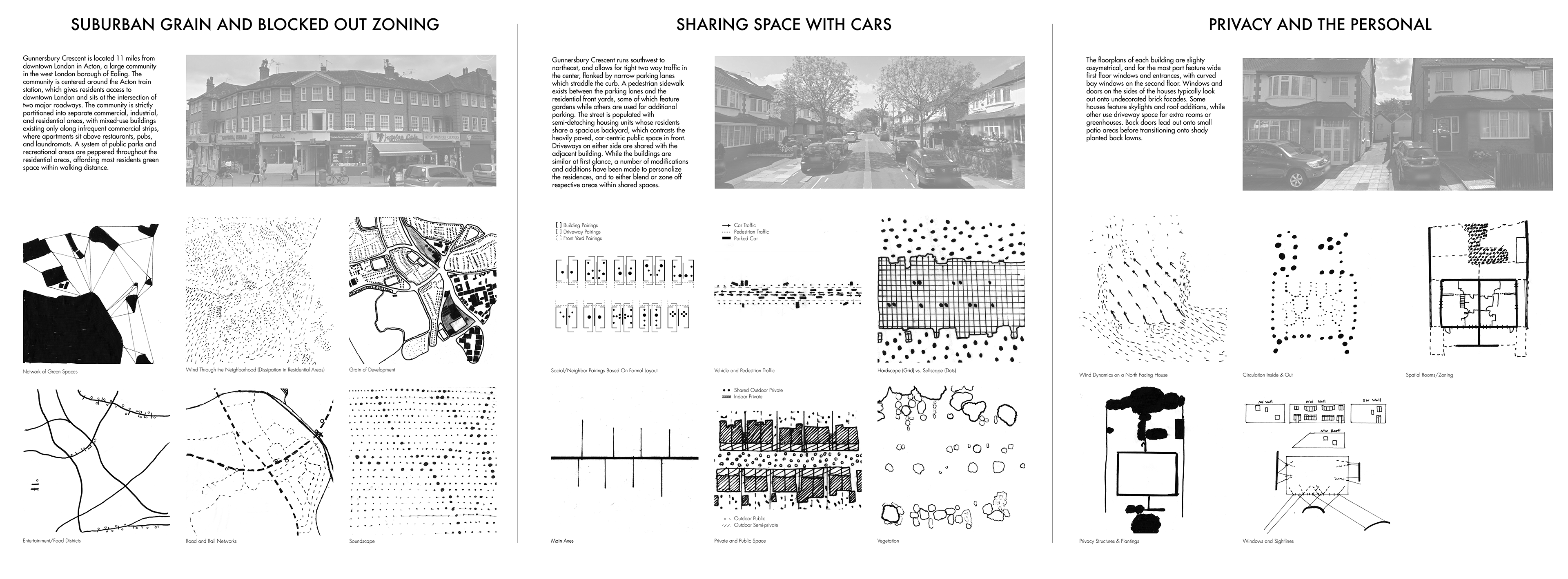
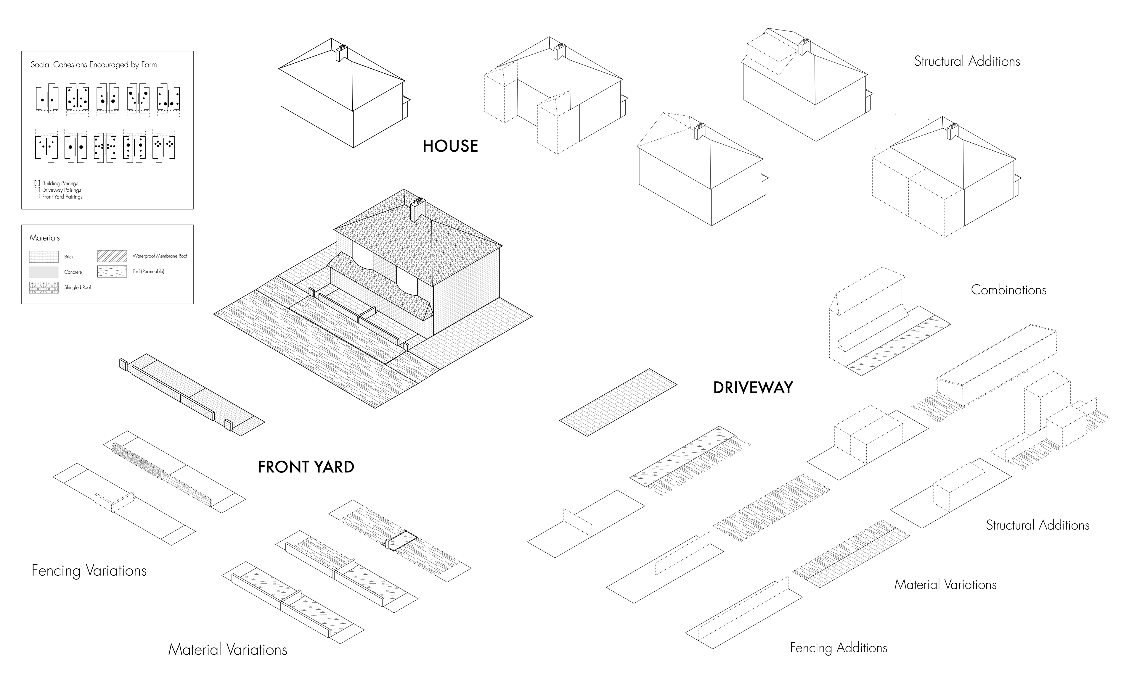
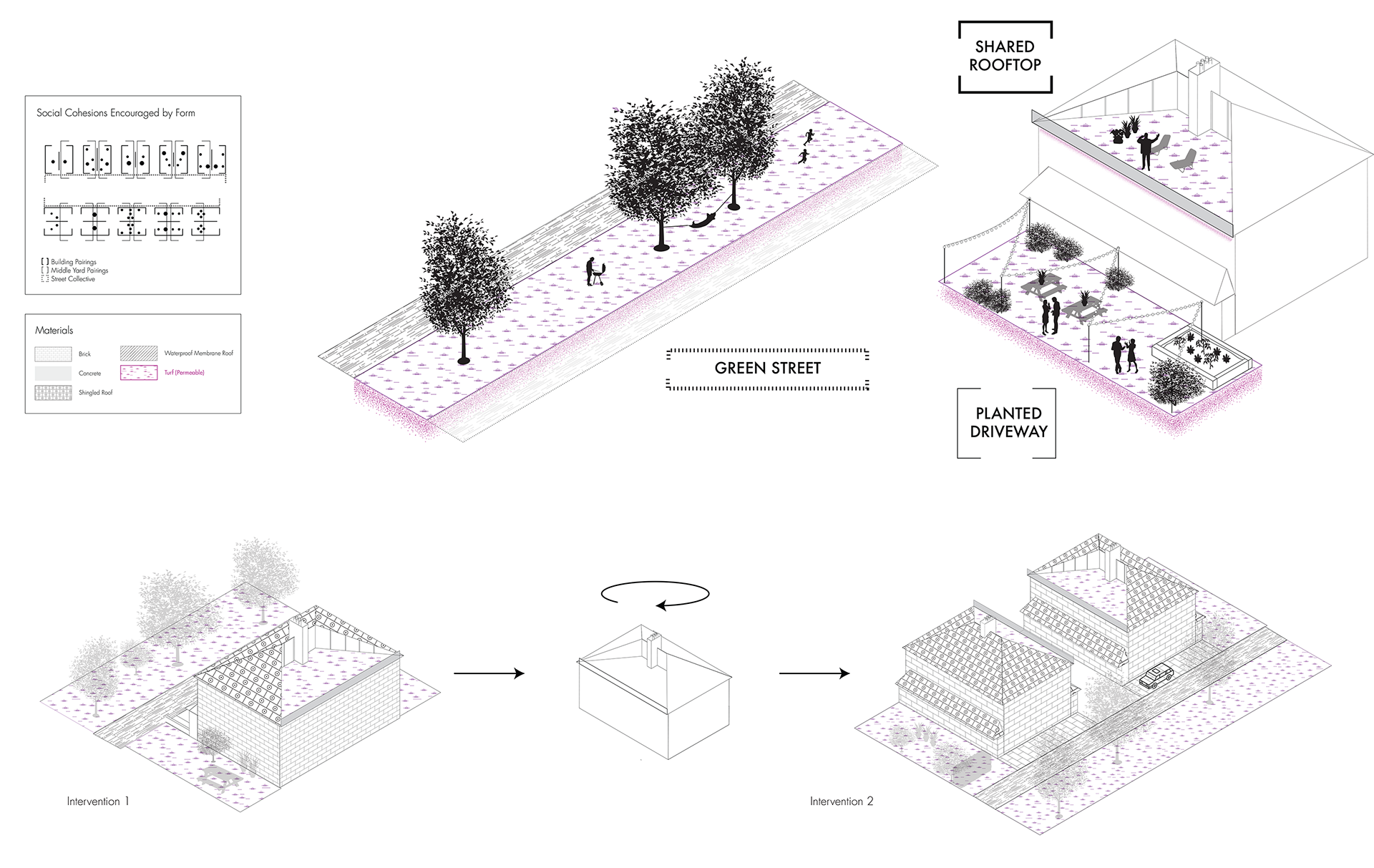
The map above charts how historic tributary routes have informed and become embedded within the city’s urban form. The subsequent explorations below catalogue material idiosyncrasies within London’s monotonous, car-centric suburbs, and serve as a launching point for designs which reframe atomized neighborly relationships around more permeable, pedestrian-friendly shared spaces.